Antarctica
- dougsmith51
- Mar 11, 2023
- 5 min read
Updated: Mar 27, 2023
The "jewel in the crown" portion of our voyage began on Saturday, March 4 with a visit to Elephant Island. Elephant Island is where Ernest Shackleton's crew sheltered while he and five others sailed to South Georgia in search of rescue. It is mountainous and almost completly void of vegetation. and sits above the end of the Antarctic peninsula.
If you look at Elephant Island from space, you can see how it got its name, as it looks like an elephant's head.

We did not go ashore, but the captain sailed the Fram relatively close to the spot where the crew of the Endurance set up camp. It's known as Point Wild, in honor of Frank Wild, Shackleton's right hand man. When we'd first heard the Shackleton story, we'd imagined Elephant Island as quite small. It's not.

The mountains on the island are very steep, dropping directly into the sea, there are many glaciers coming all the way down to the ocean, and only a handful of flat areas can be found on the entire island. Point Wild turned out to be a little spit of land off the side of Elephant Island and it was much smaller than we imagined. Over 20 members of Endurance crew set up camp near the area indicated by the arrow, and stayed there until they were finally rescued after four months.

Then it was on to Antarctica proper! If you look at a map you can see the continent is mostly round, but has a peninsula that reaches up toward South America. It is this peninsula that all cruise ships explore, rather than mainland Antarctica. It's also the reason all cruises leave from South America (either from Punta Arenas in Chile or Ushuaia in Argentina), since the Drake Passage can normally be crossed in just a couple of days.

We spent four days traveling up and down the Antarctic peninsula. On our first day, we visited Tay Head, an island mostly covered by an ice field but with a rocky beach where we could land.

There were a number of fur seal and elephant seals hanging around the island, and we saw some jockeying for position of alpha male in each species.
Gentoo penguins, with their brushy tails, walked by on the snow.


The bay where the ship anchored was dotted with big icebergs. We really felt like we were in Antarctica!


The ship relocated to Hope Bay, and we went out for rides in zodiacs to see a glacier and a penguin colony. It was super windy with a lot of spray. We saw a leopard seal tearing (literally) into a penguin in the water, but unfortunately were not able to film it.
Day two took us to two of the South Shetland Islands, which sit just north of the Antarctic Peninsula. We stopped first at Aitcho Island where we visited two penguin colonies. One of the colonies was of chinstrap penguins, distinguished by a thin black stripe on the lower part of their face. Many of the chinstraps were molting to replace their feathers in time for winter. Mostly the penguins just stand around (since the process of growing feathers is energy intensive) preening out old feathers, having bad hair days, and growing new feathers. They don't eat during the 3-4 week molting process because they can't swim until their new feathers grow in to provide insulation and buoyancy while they are in the water.

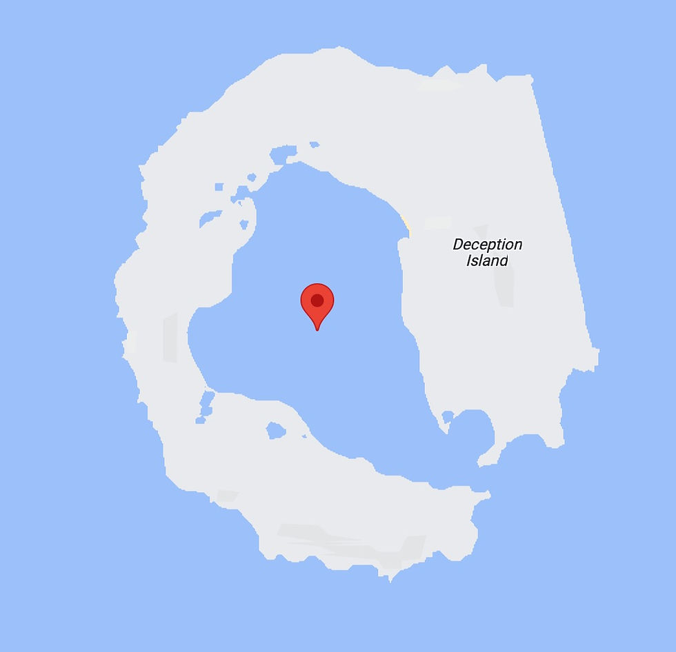
In the afternoon, we moved to Deception Island, so-called because it's not a regular island but a volcanic caldera, where the cone collapsed after an eruption 10,000 years ago and the sea flooded in.
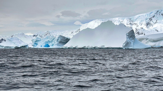
Most of the South Shetland islands are covered with snow and glaciers (see the photo below).

Deception island is not. It's still an active volcano (the last eruption was only 15 years ago) and the underground warmth keeps the island glacier-free, albeit snow-covered at higher elevations.
The entrance into the island is quite dramatic. The captain had to thread the ship through a passage only 200 meters wide (see the timelapse below). Once we were through, we turned right and parked the ship in an area called Whalers Bay.
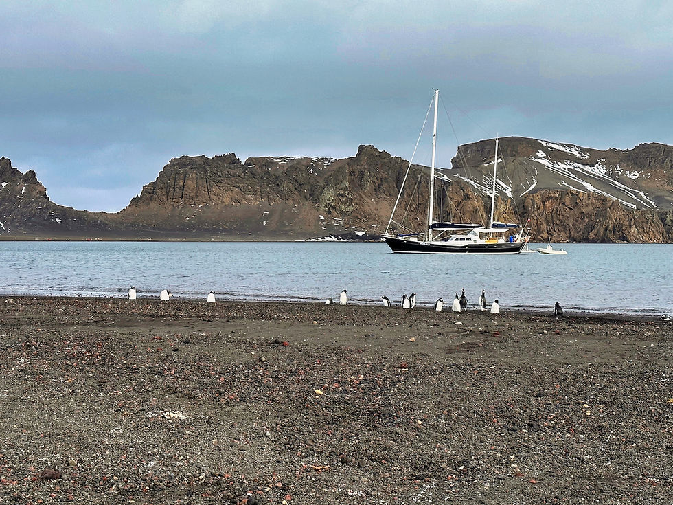
We hiked along a long beach of black volcanic sand and up to a notch where we could look out to the sea beyond.


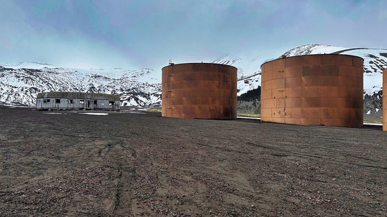
We also visited the remnants of an old British whaling station that was abandoned in the 1960s.
A few gentoo penguins were staying on the beach. One kept diving into the water, swimming, coming back out, and parading on the beach in front of us. He was so fast in the water that he created a wake behind him.
We left the South Shetlands and headed back toward the Antarctic peninsula. On the morning of our third day we visited Cuverville Island and two small colonies of gentoo penguins living there.

This late in the season, the gentoos had worn highways in the snow to uphill nesting areas.

Some of the penguins were molting and there were also some young penguins who still needed to lose their downy coats. The expedition team told us that the snow on the island had melted late this year, delaying egg laying and births. Some of the young may not mature enough before winter arrives. Climate change has far reaching consequences.

We moved to Neko Harbour in the afternoon, an opportunity to set foot on the peninsula itself rather than an Antarctic island. We were told that Neko Harbour was renowned for its glaciers and icebergs, and we could see why!
We found that one of Hurtigruten's sister ships, the MV Roald Amundsen, had spent the day in Neko Harbour. They started their departure as we were coming in.

Doug had signed up for a photo cruise using a zodiac where they would look for opportunities to shoot icebergs and wildlife.

They first saw a whale surfacing through the pack ice, but could not go into the ice to get closer.

Then they saw that two humpback whales were playing near the Amundsen and went over to investigate.
At the end of the photo cruise, Doug was dropped at the landing site, a beach near a very active glacier and a gentoo penguin colony. On the way to the beach, they passed by a group of kayakers from the Fram.

There was a small colony of penguins nesting on a rock face backdropped by dramatic tidewater glaciers filled with crevasses. Unusual for Antarctica, there was little wind, and we could hear the gentoo penguins calling to one another (turn up the sound on the video below to hear them).

A number of mothers looked after still-small babies. Some had multiple chicks.

We felt excited to be on the Antarctic mainland proper.

Toward the end of our time on shore, we saw a group of gentoos returning to land, porpoising through the water, and coming ashore together.
As we waited for a zodiac to take us back to the Fram, a large piece calved off the glacier on the other side of the inlet, causing a wave that washed up on shore about 30 seconds later. The crew had asked us to wait at the top of the beach against just such an eventuality, and they ran to collect gear from the potential splash zone.
That evening, after dinner, the expedition team showed us a wind and storm map for the next few days, and told us we would need to cut our time in Antarctica short by a day since we would have the seas working against us the entire way back to Punta Arenas.

So, the next morning we cruised to a final beautiful Antarctic location. Called Hidden Bay, it has a narrow entrance hard to see from outside that opens into a large bay filled with icebergs. The entrance is framed by 2,000+ foot-high stone pillars.

We were able to tour the bay on zodiacs, getting close to the icebergs and also spotting some fur seals and Weddell seals.

Finally, it was time to return to the Fram.

Once everyone was back on board, we sailed west and then north to start our voyage back to South America.














Just glorious!! Thank you so much for sharing this adventure.