Idaho - More Than Just Potatoes
- dougsmith51
- Sep 2, 2020
- 6 min read
Updated: Sep 2, 2020
After sweltering in Utah, we were glad to get to the cooler temperatures of Idaho at the beginning of August.
We'd only been in Idaho once before, last year when we visited friends in Couer d'Alene, which is by the purple arrow in the north part of the map below. Idaho is a tall and skinny state, with two states (Washington/Oregon and Montana/Wyoming) on each border. This time, we devoted ourselves to the southern half of the state, traveling through the area in the purple box.

We also took advantage of our proximity to Wyoming to pay visits to Grand Teton and Yellowstone National parks - those visits are documented in our previouz blog entry.
Our first Idaho stop was the little town of Tetonia, Idaho, which sits on the west side of the Tetons. Most people see the Tetons by visiting Grand Teton National Park on the Wyoming side, but they are just as lovely from the Idaho side, as you can see in the photo from our campground below.

While driving from Tetonia for a day visit to Teton NP, we passed a drive-in movie theatre called "The Spud" and knew for sure we were in Idaho!

There are many farms in the Teton Valley section of Idaho, and some of them grow potatoes in addition to alfalfa and hay. Potatoes (above ground) are low-growing green plants with small white flowers.

While staying in Tetonia, we visited Sue Zsamar Hunter, a high school friend of Doug's. She and her husband have a summer home near Tetonia with amazing sunset views of the Tetons, which we took in while sipping wine on their back porch.
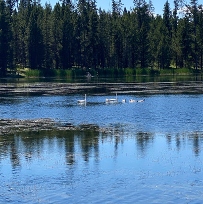
We visited a number of state parks during our time in eastern Idaho, including Harriman State Park (donated by Averil Harriman of diplomat and Union Pacific fame), where we hiked about five miles around the perimeter of Silver Lake. We saw a pair of swans and their young cygnets.
We also visited Mesa Falls State Park, featuring two thunderous waterfalls with rapids between.
Finally, we visited Big Spring, where 120 million gallons of water per day spill out from under a hillside and form the source of the Snake River.

Bidding adieu to eastern Idaho, we headed toward the middle of the state and the small town of Arco, where we camped for two nights so we could visit Craters of the Moon National Monument. Craters sits atop a 52 mile long rift in the earth where, over time, millions of tons of lava have oozed out of the earth and cinder cones have formed. The most recent eruptions were only 2,000 years ago, and scientists believe there will be more eruptions in the future.

Some of the landscape reminded us of Volcano National Park in Hawaii, with both smooth ropy lava (pahoehoe lava) as well as as sharp chunks of pumice and basalt (a'a lava). There were even pieces of obsidian with small glass beads embedded in them.


In the last 2,000 years, plants and lichen have been able to take hold in some areas, although there is still a fair amount of exposed black lava and cinder left.
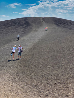
We hiked up to the top of Inferno Cone where we had a 360 degree view of the surrounding landscape.
We also visited a set of small "splatter cones" formed during the most recent eruptions. One, Snow Cone, still had snow from the previous winter inside the small crater even though it was mid-August with temperatures in the high 90s.
We also took a hike out to an area with "tree molds" where lava had flowed over trees, and hardened with casts of the bark when the trees eventually eroded away.

We then moved north and west to the small town of Stanley, Idaho, which sits near the craggy Sawtooth Mountains. The year-round population is less than 70 people, but it swells in summer with people coming for hiking, biking, mountain climbing, rafting, and driving off-road vehicles. Despite its small size, Stanley has several great restaurants. We also visited the nearby Redfish Lake Lodge, with its beautiful lake setting, for dinner one day.

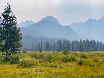
We had initially booked our time in Stanley so we could both have a week of downtime (we'd been on the move a lot in the previous two-and-a-half months), relaxing with magnificent views. Unfortunately, we arrived at about the time the California wildfires went into overdrive, sending plumes of smoke up into Idaho (you can see on the map below that we were in the thickest plumes), and our views of the mountains were hazy at best and sometimes non-existent.


The smoke and haze also made for blood-red sunsets.

One day we drove along the Salmon River Scenic Byway, which follows the Salmon River from Stanley about 60 miles northeast to the town of Challis. River rafters were out in force.

Near Challis we visited the ghost town remains of Bayhorse, a mining community active in the 1880s and 1890s.
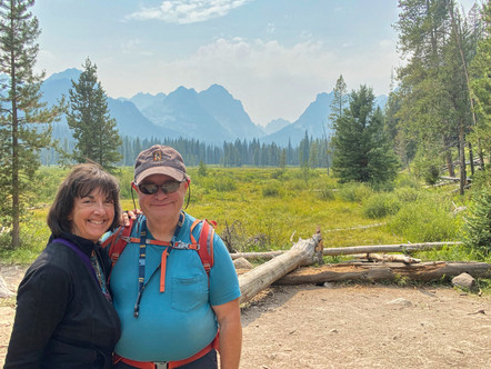
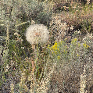
Another day we hiked the Fishhook Creek Trail near Redfish Lake, site of a popular resort built on U.S. Forest Service land near Stanley. The trail leads to the edge of the Sawtooth Wilderness, and is lined with forests, desert plants, wildflowers, meadows, and quaking aspens (which will all be turning bright yellow in a few weeks).
Before leaving that area , we drove the shore of Redfish Lake to take in the view.

We also drove to another lake in the vicinity, Stanley Lake, to take in the [also smoky] view there.

It rained during our last night in Stanley, and in the morning we had a somewhat improved view of the Sawtooth Mountains, although still fairly smoky. Doug was able to do some post-production work to clear the photo up a bit more (see rendering on right), but the haziness is still quite apparent.
As we left Stanley, we agreed that we need to come back in the future so we can experience the mountains, rivers, and scenery in their full splendor.
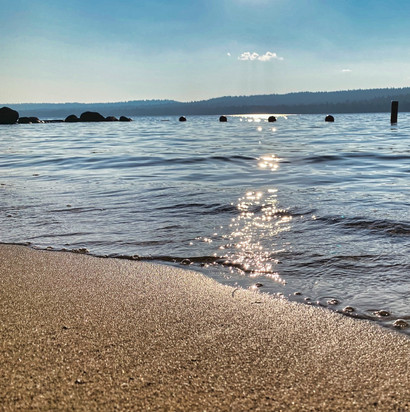
Moving on from Stanley, we travelled northwest to Ponderosa State Park near the town of McCall. It's located on a peninsula sticking out into Payette Lake, and is named after that stands of mature Ponderosa Pines throughout the park.

The campsites were large and wooded, with woodland creatures who were clearly not intimidated by the campers.

McCall is a small resort town with activities centering around beautiful Payette Lake, and also mountain and trail biking.

One day we hiked for about 5 miles through the park, combining trails that highlighted the shoreline and also a large marsh in the center of the peninsula. Another day we drove around the perimeter of the lake, and then to a lookout at the end of the peninsula.
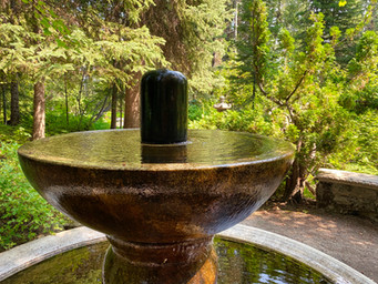
When we searched for "Things to Do in McCall" on TripAdvisor, we read about Charlie's Garden, a small but beautiful local garden created by a family 50 years ago and now maintained by volunteers and neighbors, and stopped by for a visit.
McCall turned out to be the northernmost destination of our 2020 Ciaowagen travels (be sure to look at the "Travels" tab of our website to see where we've been), and we turned south to Boise, the largest city in Idaho and also the state capital.
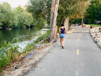
We spent much of our time in Boise catching up on the mundane things of life - buying groceries, receiving Amazon packages, filling prescriptions at CVS, getting flu shots at Walgreens, and visiting hair salons and nail spas. We did take a day, however, and after renting bikes from our campground, rode on the Boise River Greenbelt, a beautiful 26 mile paved trail that runs on both sides of the Boise River, through downtown and out into the country. Near the downtown area, we got off our bikes and visited the Idaho Anne Frank Human Rights Memorial, honoring not only Anne Frank but human rights heroes from around the globe.
While on the Greenbelt we also visited the Boise Whitewater Park, a place the city has built on the river where they can control the rapids and wave forms, allowing kayakers and surfers (wet suits required!) to practice their craft.

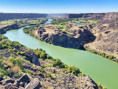
We finished up our time in Idaho by visiting the city of Twin Falls. One of its primary attractions is the Snake River canyon. About 10,000 years ago, at the end of the last ice age, melting snow and ice created giant Lake Bonneville in Utah and Nevada, about as big as Lake Michigan. As the waters rose, a natural rock dam collapsed and the lake emptied out in a torrent that lasted about six weeks (today's Great Salt Lake is all that remains of the giant lake). The flood was so strong it carved a 500 foot deep canyon with vertical walls in just those few weeks.
The Perrine Bridge crosses the gorge and serves as a popular stop for B.A.S.E jumpers (although no one was parachuting off when we were there).

Just a few miles upriver from the bridge is 200 foot-high Shoshone Falls, one the prettiest waterfalls we think we've seen, even at relatively low river flow.

It was time to continue our travels south, and we headed into Nevada and Utah to visit some more national parks and monuments. More about those visits in our next blog entry!











































UMMMM...you do realize that the majority of us are locked in our homes and bored to death?!? Your adventures continue to look amazing! Great pictures and facts and I especially like Big Spring. You have put together a great bucket list for me...would you mind cat sitting Bill for a few years? ;) Glad your travels are going so well and "retirement" looks fabulous. Need an RV driver?