
Newfoundland
- dougsmith51
- Jul 3, 2022
- 6 min read

Newfoundland is an island, albeit a big one. It is considered a single Canadian province with Labrador, which sits on the mainland above Quebec. Although we’d been to Nova Scotia before (1993) it was our first visit to Newfoundland. To get there, we needed to put the Ciaowagen and Fittata on a ferry.


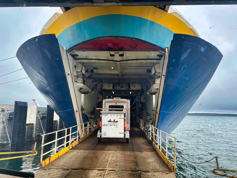
We made our reservations about six weeks before traveling but should have made them even earlier, as we were not able to get our first request and had to reshuffle our planned itinerary. Marine Atlantic operates ferry service from North Sydney, Nova Scotia to two Newfoundland ports. We chose Argentia on the east coast. We toured Newfoundland counterclockwise skirting the coastline since there are few, if any. roads in the interior. We ended up in Port-aux-Basques on the west coast for our return ferry to Nova Scotia.

The Argentia ride is nominally 18 hours, an overnight voyage. When we booked our passage, we were not able to get a cabin onboard, and spent our night instead in a lounge that had reclining seats, similar to economy seats on a plane but with much more legroom.
The voyage to Newfoundland took longer than expected because of high winds at our destination port. We began to notice the same islands appearing again and again off the port side windows. Jeannette consulted with the ship’s purser who said that the ship was doing the marine equivalent of circling an airport until we were able to dock. No one aboard the ship would venture a guess as to when we might dock, but luckly, the seas themselves were very calm. Passengers were getting restless. The ferry's restaurants did not open for lunch, the snack bar was getting emptied fast, and to top it all off, there were no deck chairs to re-arrange to pass the time. Finally, about 22 hours after leaving Nova Scotia, we were able to dock. We were one of the first vehicles off the ferry and drove for about 75 minutes to Newfoundland’s capital city of St. John’s.
St. John’s is the largest city on the whole island and originally was the site of an early Viking settlement. While small, it has a lively downtown. It also has a hilly terrain like San Francisco, arrayed along a beautiful and sheltered harbor that has made it a key port because of the North Atlantic fishing banks nearby. It even played a part during WWII as an ice-free port that served as a staging area for many of the convoys headed to Europe.

We visited Signal Hill, a National Historic Site, sporting Parks Canada red Adirondack chairs at the visitor center. Signal Hill overlooks the city and was key to the harbor’s protection. Like many of the sites in Atlantic Canada, it changed hands multiple times between the French and the English.
Cabot Tower was built atop the hill in the 1800s and provides beautiful views of the city on one side and the Atlantic Ocean on the other, including a lighthouse and the ever-present coastal fog. The tower was also the place where Guglielmo Marconi received the first trans-oceanic radio signal in 1901.


We then traveled about a half-hour to Cape Spear, the easternmost point in all North America and the location of a historic lighthouse.


It is here that the sun’s first rays reach land along the whole eastern coast. The city proudly proclaims its status as “where the day begins.” Jeannette figured out that Cape Spear also was the place that happy hour began in North America.


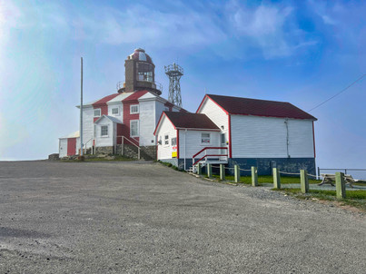
Next day we traveled to the Bonavista area where we camped for two days at Lockston Path Provincial Park about halfway along the peninsula. We visited the lighthouse at Bonavista Point where the coastal fog visited us again.


Nearby stood a statue of explorer John Cabot. Cabot was actually a Venetian (Giovanni Cabatto) who traveled for Henry VII of England in search of a sea route to Asia. Although not officially documented, legend has it that Cabot first landed in North America at Bonavista Point in 1524.

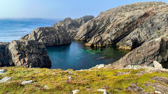
We traveled back down the peninsula to Tickle Cove which has a lovely sea arch set among pink rocks.


Driving back to Lockston Path we passed by the picturesque hillside village of King’s Cove and stopped to take a picture.

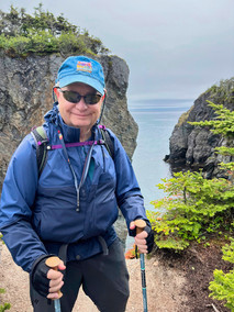
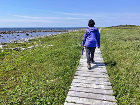
We finally had some sun on our second day in the Bonavista Peninsula and took advantage of it to hike the famous (at least in Newfoundland) Skerwink Trail.


Well maintained by the local townsfolk, the three-mile trail winds among forests, over boardwalks, and alongside dramatic cliffs. It provided a lot of dramatic views and we were amazed at how clear and blue the ocean was.

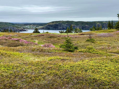


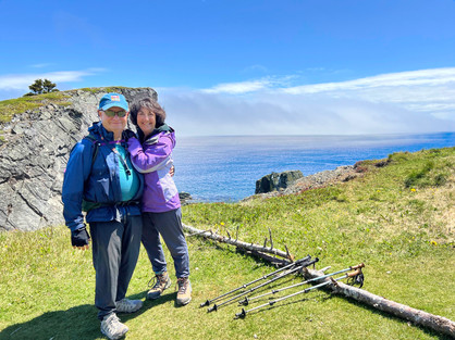


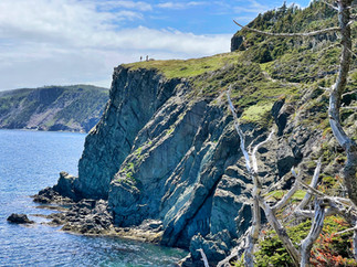


We thought it one of the prettiest hikes we’d ever taken.
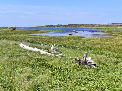
Then it was time to move on again and we headed north and west to the Twillingate area. We stayed at Dildo Run Provincial Park. Dildo seems to be quite a popular name in Newfoundland (perhaps it’s the long, lonely winters?).


Twillingate lies along “Iceberg Alley” where icebergs breaking off from Greenland travel along the Labrador Current. Unfortunately, locals told us the last icebergs of the season had passed through about two weeks before, along with the whales who also frequent the area.

We drove to the end of the Twillingate peninsula and took another cliffside hike with beautiful views of offshore rocks and colorful fishing villages in the distance.

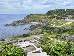


Although the next day was rainy, we hiked within the Provincial Park to a viewpoint along Dildo Bay.


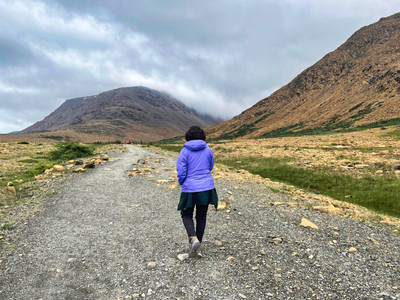
The following day was a travel day, taking us west to Gros Morne National Park. Beautiful and dramatic, it has well-deserved status as one of the premier Canadian national parks. Gros Morne is particularly famous for the variety of its geology and is UNESCO-protected in recognition of its unique landscapes.


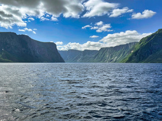
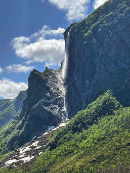
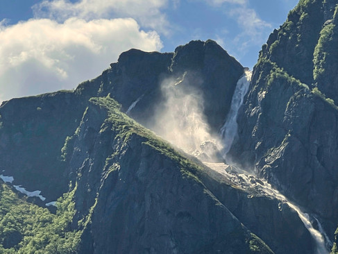
On our first full day in the park, we drove along the coast, parked, and then hiked two miles inland to the shore of Western Brook Pond.

Created as a fjord during the last ice age but now landlocked, the “pond” (it can’t be called a fjord because it no longer connects to the sea, but it does have the requests steep towering sides) is about 10 miles long, passing through vertical, 2000-foot-high cliffs.


We took a two-hour boat tour the length of the pond, in awe at the cliffs and waterfalls. It reminded us of Yosemite Valley but filled with water.


Hiking back to the car, we heard a bird chirping, and found this tiny bird peeping at us from a hole in a tree. A group of bird enthusiasts were on the same trail and identified it as a downy woodpecker chick, making a racket because it was wanting to be fed.

Later that day we hiked the Ocean Trail along the Gulf of St. Lawrence.


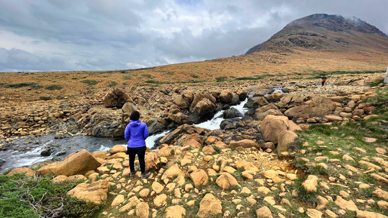
The next day we visited the Gros Morne Discovery Center (which provides in-depth info about the formation and geology of the area) and then moved on to the Tablelands, one of the very few areas on the planet where the rocks exposed came directly from over 100 miles below the earth’s crust, originating in the Earth’s mantle. They were pushed up to the surface by unusual plate tectonic forces.

The rock is an interesting orange color due to the high iron content of the mantle rocks which rusted when exposed to oxygen at the surface. Very little plant life grows on the mountainsides because the rocks contain toxic metals not normally found in the crust rocks. The little vegetation present is specially adapted to the geology of the area, as well as the water in the area which has very high pH.


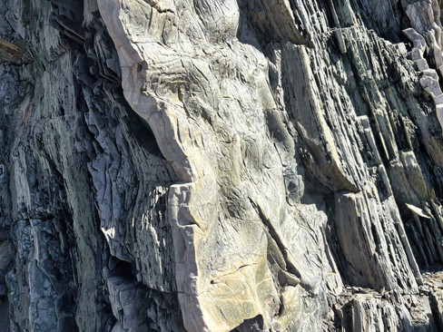
Our final morning in Gros Morne we attended a ranger program along the coast at a place called Green Point. The particular area has been identified as the “world standard” for the dividing line between rocks of the Cambrian period and the Ordovician period, a period change that occurred about 500 million years ago.

The cliffs originated from underwater sedimentation on the continental shelf as the supercontinent of Pangaea was pulling apart. Later, the rocks were pushed to the surface, then rotated vertically (actually, they were rotated more than 90 degrees).

The result is a landscape of thin shale layers (each 1 mm sliver of shale representing about 100 years of mud deposits on the ground) alternating with thicker limestone deposits resulting from downhill avalanches of calcium carbonate from crustacean shells.


Toward the far end of the area (actually more recent deposits) were strange, rippled conglomerate rocks composed of a variety of rock types that cemented together. One formation looked like large pieces of a concrete road.

We drove that afternoon to a campground about three hours south and the next morning boarded the ferry for the much shorter (six hour) sail back to Nova Scotia from Port-aux-Basques. We camped overnight nearby, and then took off the next day for the four hour ride to Prince Edward Island. More about PEI in our next blog post!


Love all the geology!