
Nova Scotia
- dougsmith51
- Jun 25, 2022
- 5 min read
Updated: Jun 30, 2022
As we noted in our last blog entry, transmission problems with the Fittata kept us stuck in Virginia. However, our local transmission shop was able to beat their initial estimated of 15 days to rebuild the transmission and got the car back to us in 8 days. We left the following day, and thus only lost five days off our planned time in Nova Scotia.
We drove back to Freeport, Maine in a single day, and then took the Ciaowagen and Fittata across the Canadian border the next day, overnighting in St. John, New Brunswick.
The next day we completed our drive to a KOA close to Halifax, Nova Scotia, the provincial capital and our destination for the next three days. Nova Scotia means “New Scotland,” and the presence of celtic and gaelic elements can be seen across the city.
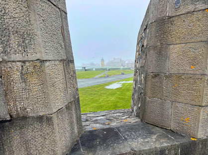
On our first full day in the area, we traveled downtown. The city of Halifax is an island, with multiple bridge and ferry crossings from the mainland town of Dartmouth. We visited the Halifax Citadel, a National Historic Site, which once guarded the city’s harbor.

In addition to walking the Citadel’s walls (which offered great views of downtown), we were treated to a bagpipe performance.

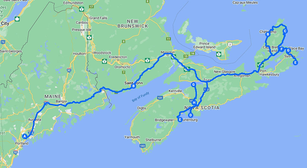
We drove down to the waterfront, which has been developed into a great walking and tourist area in recent years. There was a lot of public art, including statues of women of different backgrounds contributing to the war effort, a man leaving his family to emigrate to Canada, and some fairly loopy street lamps.

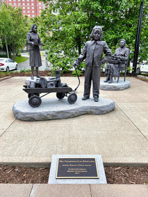

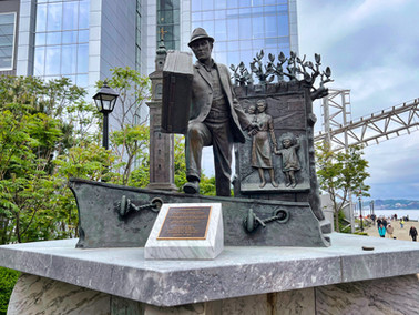


While at the waterfront, we visited the Immigration Museum which sits at Pier 21 (the Canadian equivalent of Ellis Island) where almost 1 million people arrived from overseas to find new lives in Canada.

One of the exhibit areas illustrated immigrants’ experiences traveling on ships from abroad, arriving at Pier 21, being processed by immigration officials, and then moving onto trains to settle elsewhere in Canada. In the past few decades, Canada has really tried to celebrate its diversity, and that was very much in evidence at the museum.


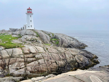
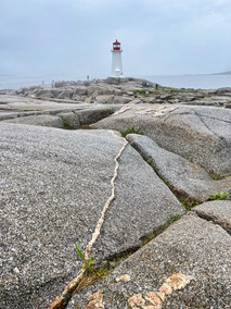
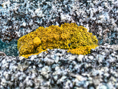
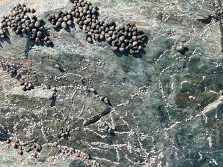
The next day, a misty and foggy one, we traveled along the coast to scenic Peggy’s Cove, where we walked around a lighthouse on gravel rocks that had been worn down by glaciers during the last ice age.


Nearby, there was a memorial to Swissair flight 111 which crashed just off the coast in 19?? killing all 200 people aboard.


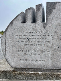

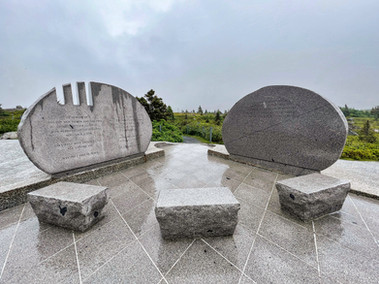


From the memorial site you could see Peggy’s Cove in the distance, swathed in fog.

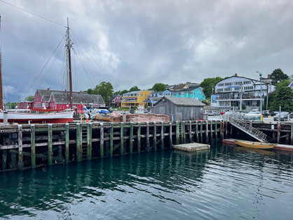
We drove further down the coast to the village on Lunenburg, a UNESCO World Heritage Site (something to do with its layout as a classic British town).We enjoyed the colorful buildings along the waterfront.

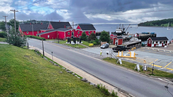

A fishing town, there’s a moving memorial to fisherman who died at sea.

Lunenburg is also the home port of the Bluenose II, Nova Scotia’s official long ship. When we visited, it had just come back from a day cruise and the crew was busy stowing the sails.

After watching them stow the main sail, Jeannette swore she would never again complain about putting sheets on bunk beds. Lunenburg also hosts a large number of art galleries and restaurants.
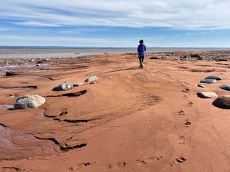
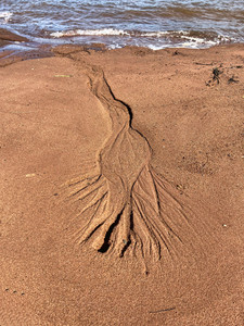
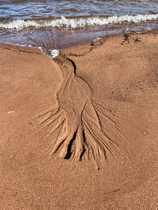
The day after (finally a sunny one), we traveled an hour across Nova Scotia to the Bay of Fundy. We visited Burntcoat Head Park, the site of the highest tides in the world (averaging 49 feet with maximum tides of 54 feet). We arrived just after low tide, when the waters had receded about a quarter mile, and we were able to walk on the ocean’s bottom for about an hour-and-a-half.

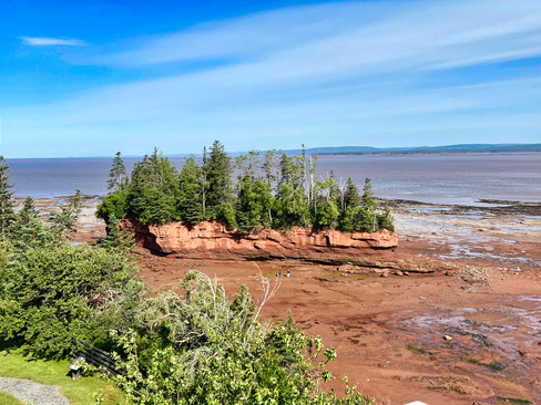


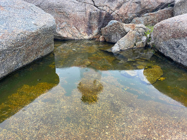
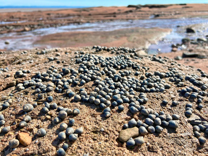
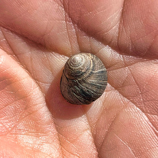
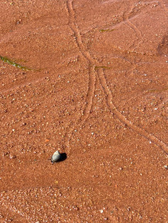
We hiked all the way around what is, at high tide, an island. We found sandy ripples of sand, many small crustaceans, tracks left by snails, and green sea moss.


Walking to the water’s edge, we could see the tide already starting to come in (the two pictures below were taken about three minutes apart).


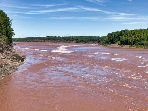
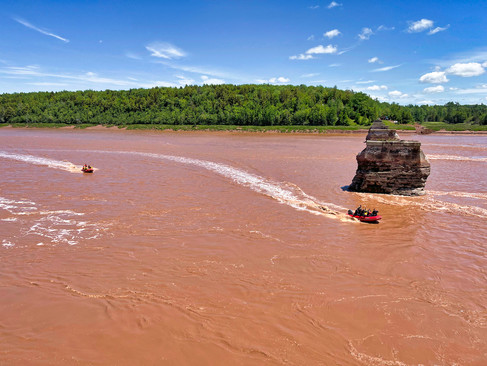
Driving about 20 minutes to the mouth of the Shubenacadie River at the end of Bay of Fundy, we watched for the tidal bore where the incoming tide meets and then overcomes the water flowing out of the river, causing a wave that reverses the flow of the river.

After watching the bore at the river’s mouth, we drove 7 miles upstream to see it again near the Fundy Bore Interpretative Center where a platform juts over the river at the site of an old railroad bridge. We watched the river reverse course and the bore pass again and stayed to watch some rafters who were riding the bore.


You can see the bore moving upstream in the movie below.
We finished our day by returning to the Halifax Waterfront to walk portions we’d missed our first day. We enjoyed a delightful seafood dinner near the ferry terminal where boats travel every few minutes to two docks in different parts of Dartmouth on the mainland.

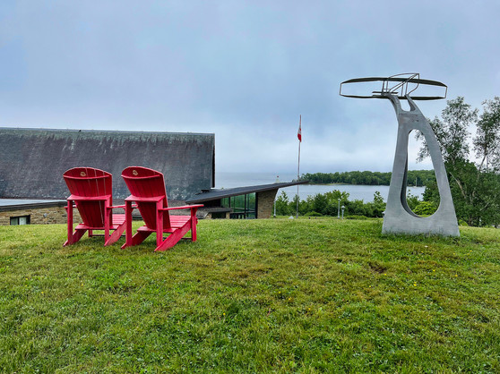
It was time to move four hours north to Cape Breton Island which makes up the top of Nova Scotia. We arrived at a KOA with a beautiful view of Bras d’Or Lake which runs down the middle of the island.


The next day was cloudy and windy - typical weather for Nova Scotia, we were finding. Jeannette marveled at the sun-bathed pictures that graced all the brochures we’d and felt sure that the marketing people making the brochure had spent a lot of money keeping photographers on-call just in case the sun came out.
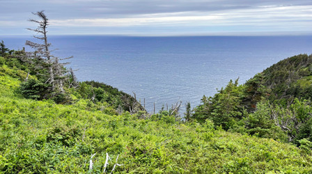
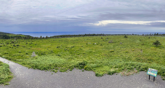
We spent the day driving the 150-kilometer Cabot Trail which winds around a peninsula that includes all of Cape Breton Highlands National Park. The road provides dramatic vistas reminiscent of the California coast as it climbs up and down rocky cliffs.


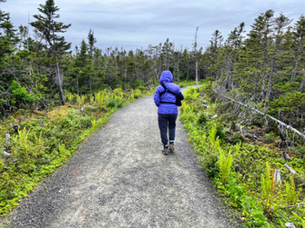
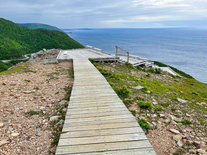
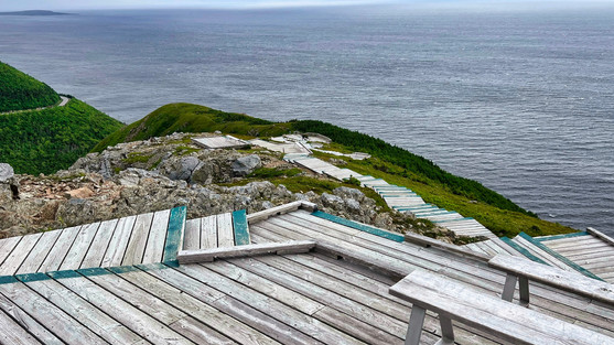
Along the way, we stopped and hiked the five-mile Skyline Trail which winds around the top of flat headlands and leads you to dramatic views of the ocean.


The trail was quite beautiful, although when we reached a boardwalk section at the cliffs the wind was blowing fiercely at least 60-80 miles per hour. The wind was howling so much that Doug had a hard time holding his iPhone steady for photos.


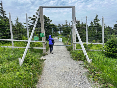
On the way back to our car, we hiked through an enclosure. It appears the resident moose population has been eating too many spruce shoots and denuding the headlands. The enclosure was built to allow the land to recover.


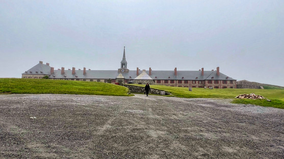
The next day we traveled to the east coast of Cape Breton Island to the Fortress of Louisbourg, another National Historical Site. Although it was sunny when we left our campground, it became quite foggy as we reached the ocean.

Louisbourg was one of the most active fishing ports in the 1700s when the area belonged to France, and a fortified town was built housing some 5,000 people. Over the next 100 years the town moved back and forth between French and British control as various wars were fought and peace treaties signed (over in Europe, of course, without consulting the locals). The town eventually fell into ruins before it was “reconstructed” in the 1960s as part of a jobs project for unemployed coal miners.
Parks Canada operates the site (representing about a fifth of the previous town area) in a manner similar to Williamsburg with guides in period costume explaining aspects of local living, the military, and various trades.


We also took a guided tour which was quite informative.

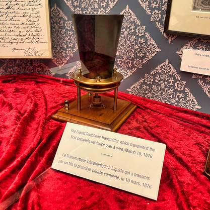
Our final day in Nova Scotia we drove about 15 miles south of our campground to the town of Baddeck on Bras d’Or Lake. Alexander Graham Bell spent the latter part of his life in Baddeck and used the money he’d earned from inventing the telephone to continue scientific explorations. He helped develop the first Canadian airplane (which one an international prize for longest sustained flight) and also experimented with hydrofoils, setting several world speed records. Parks Canada operates the Alexander Graham Bell National Historical Site with an excellent museum that includes early telephones and modern replicas of one of his airplanes and a hydrofoil boat.


Leaving Baddeck, we returned to our campground, hooked the Fittata to the back of the Ciaowagen, and drove to the Atlantic Marine ferry terminal nearby for our overnight voyage to Newfoundland.
More about Newfoundland in our next blog post!


Comments