
[NOTE: This blog entry follows on directly from our last one, profiling our travels in the first half of September 2020. We'd decided to split that time into two entries after realizing what a long post we'd have.]
From the Salt Lake, we headed down toward southwestern Utah, camping in Cedar City, and moved into what felt like "Park-a-Day" mode for a week or more.
First up, we visited the Kolob Canyons section of Zion National Park. Zion National Park is very popular (3rd most visited National Park in the country), but the Kolob Canyons section, which lies to the northwest and has a separate entrance off Interstate 15, is not visited by many people. As you drive up into the canyon, the views of what's coming are enticing.

There's a scenic drive that goes five miles into the canyon. Along the drive, you can see the whole Kolob area laid out before you with sheers walls of red rock and a number of side canyons.

You remember the smoke we experienced by the Salt Lake from the West Coast wildfires? You may also remember from the news that there was a record-breaking heat wave that covered the American west high before Labor Day, followed by what we can only describe as a temperature crash where the highs went down by 50 or 60 degrees, including freezing temperatures at night. That change brought 24 hours of high winds. While it cleared out the skies, there were times when we felt we were being blown off our feet. Click to watch the video below, and be sure your sound is turned up.
On the other hand, the high winds made the clouds roll by, as you can see in the time-lapse video below.
At the end of the scenic drive, we posed for some pictures...


... and then hiked along a mesa to an expansive view where you could see other parts of Zion National Park to the left and plains (probably in Arizona) far in the distance.

While in the Kolob Canyons area, we took a hike into one of the side box canyons, taking us into the wilderness portion of Zion NP and to a historic (now abandoned) cabin.


The next day, we visited Cedar Breaks National Monument. It bears some similarities to Bryce Canyon National Park, but is much less crowded. The most prominent part of Cedar Breaks is a 3.5-mile-wide amphitheater of multicolored rock at 10,000 feet elevation.


We hiked out to a viewpoint so we could look back into the Breaks, and found a grove of bristlecone pines when we got there. There was even a "young" bristlecone (probably only 200-300 years old) just a foot or two taller than Jeannette.


On the drive back down to where we were staying, we were treated to an expansive view looking down to Zion National Park in the distance, and even beyond.

We moved the Ciaowagen to Bryce Canyon City, UT and the next day visited Kodachrome Basin State Park. The area was given that name by National Geographic Magazine in 1948. The state of Utah got permission from the Eastman Kodak company to keep the name when they established the state park in 1962.
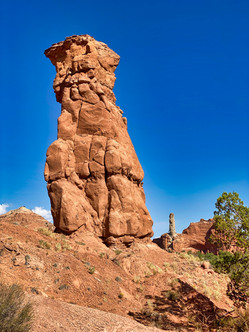
Kodachrome Basin is noted for more than 70 sandstone spires or "pipes" whose origin is still debated. They come in many shapes and sizes.

Some, frankly, are a bit phallic.


On the drive back to the campground, we had a great sunset view of mesas rising in the distance.

We spent the next day exploring Bryce Canyon National Park, which was very close to our campground. We had visited Bryce in late spring 2019, but wanted to go back since it is so striking. It's a natural amphitheater opening to the east, filled with towers called "hoodoos" left when the surrounding rock eroded away. Iron in the rock rusted once exposed, leading to brilliant orange and red colors. Higher layers with manganese have stayed whiter.

We decided to hike the Navajo Loop trail down into the amphitheater and back up - that trail had been closed last year due to a rockfall. It turned out that we had also hiked this trail in 1991 when Jeannette was six months pregnant with our son Mace and Doug was carrying our son Tory in a backpack. We'd also brought our Dutch au pair Janine out to Utah with us for that visit.

The hike down and back was steep, but gave you a very different perspective from just staring down from the top.


During our hike, we came upon a couple with two young children where the wife had badly twisted or broken her ankle slipping on a steep part of the trail. Jeannette helped keep the children preoccupied while waiting for the search and rescue team to come down. They were able to give her morphine for the pain through an IV drip right there, and took her out on a stretcher balanced on top of a bicycle wheel to help bring it up the steep trail slope.

After going back to the campground to do our laundry, we returned in the early evening for a walk along the rim as the sun set behind us. The setting sun highlighted some western wildfire smoke off to our east.

Bryce Canyon is an International Dark Sky Park. We stayed in the park after sunset and participated in a socially distanced star program where the ranger highlighted constellations, planets, and other things to look out for using a laser pointer.
We relocated south to Mount Carmel, Utah, near the eastern entrance to the main section of Zion National Park. We only stayed for one night, but had time to go into the park and hike to the Canyon Overlook, looking down from the higher eastern section to the massive canyon on the western side. We had hiked that same trail in May last year wearing heavy clothing - this time we did it in t-shirts and shorts.


After the hike, we drove through a mile-long tunnel down into the lower part of Zion Canyon. With our binoculars, we were able to look up and make out the spot we'd hiked to earlier that afternoon.


We celebrated with an outdoor dinner of crepes in the town of Springdale, UT which sits right outside the main park entrance.
Next, we headed south into Arizona (where they still don't seem to be taking COVID or mask wearing very seriously). We had booked a site at the campground on the North Rim of the Grand Canyon (remember we visited the South Rim in June when the park reopened after three months of COVID-19 closure), but got a notice a couple weeks in advance that the campground had been closed due to water main breakage. Luckily, we found another campground around 45 minutes north of the North Rim, so we were still able to spend two days exploring the park.
As we drove south toward the park, we passed through areas burned by the fires we'd seen during our June visit to the South Rim.

This had our view of the fire from the South Rim.

The North Rim is only visited by about 10% of all people that come to the Grand Canyon. Although the two rims are less than 15 miles apart, it takes more than four hours to drive from one to the other (you have to drive all the way around the Canyon to the east). The North Rim sits more than 1,000 feet higher than the South Rim, so when you look toward the south you see not only the South Rim, but also the San Francisco mountains (near Flagstaff) beyond.

Seen from North Rim, even the side canyons going down toward the Colorado River are impressively deep.

While waiting for the sunset, we hiked through the forest and came upon a group of resting mule deer.

Later, we hiked from the visitor center (still closed due to COVID) out to Bright Angel Point to take in the sunset (check out the time-lapse below).


The next day we drove along the North Rim road to Roosevelt Point (named after T.R.)...

...and then on to Imperial Point, the highest point in the national park at 8,803 feet. It looks out to the east rather than south. The Colorado River flows north to south near the Canyon wall, and you see the flat Marble Platform beyond stretching off into the distance.

When you look northeast from Imperial Point, the flat landscape stretches for miles. Here, the Colorado flows south from Lake Powell through deep but narrow Marble Canyon.

While we'd enjoyed everything we'd seen, that was a LOT of national/state park/monument visitation over a relatively short period of time. We needed a rest, so we relocated to an Arizona state park with a lake to just hang out for a few days.
More in our next blog entry...
Bình luận