
South to the Fiesta
- dougsmith51
- Oct 17, 2021
- 11 min read
Updated: Mar 27, 2022

NOTE: We’re backing up in time from the recent blog post about our visit to the Albuquerque Balloon Fiesta. The post before that one ended just as we were crossing the border from Canada back into the U.S. But what happened in between? We're about to tell you.
ADDITIONAL NOTE: This blog entry is one of our longer ones. However, it does cover a journey of almost 2,000 miles and visits to some particularly photogenic places, so we hope you'll have the patience to read through it and enjoy the ride with us.
We’d known for a while that we had to arrive in Albuquerque by October 1st for the Balloon Fiesta, we had only two weeks to traverse the many miles. We decided on a strategy of 2-3 day stays at points of interest, punctuated by strings of long driving days to get from point to point.
Our first destination was right over the border from Waterton Lakes National park in Canada: Glacier National Park in Montana.

We’d camped on the west side of the park in the spring on our trip from Virginia to Washington state. This time, we camped on the east side of the park which is in the Blackfeet Reservation. Last year the Blackfeet had closed their nation (and the eastern entrance to Glacier NP) due to COVID, which hit them particularly hard.

One of the main attractions of Glacier NP is a road, aptly called “Going to the Sun,” that goes across the park, crossing the continental divide at Logan Pass. It is a real feat of engineering - switchbacking up the side of mountains and at the higher elevations, cantilevered and barely clinging to the rockface.

When we visited Glacier in June, the road had still not opened due to snow pack.Some years they actually have to survey the road so the plows know where it is. Now, finally, it was open.
Glacier is one of the country’s over-loved National Parks, so the National Park Service instituted a pass system for entry for the 2021 season. That system had ended on Labor Day. We were surprised to find the crowds still present, with many parking lots and roadside pull-offs full.

Our first day we drove over Logan Pass, the highest point on the Going to the Sun road, and headed down toward the eastern part of the park. We stopped on the way down to look at the dramatic views of the mountains, valleys, and some approaching rain.


We hiked two trails we’d done before. The first, Trail of the Cedars, goes through old-growth forest with huge trees, and is the only national park nature trail that we know of that comes with haiku.


We also hiked the Johns Lake Trail, mostly to see the cascades and mountain views as the trail goes along MacDonald Creek, which empties into Lake MacDonald not far from the trail.


On the way back up the Going to the Sun Road, we paused to let a young brown bear amble onto the asphalt and take its sweet time crossing to the other side, completely indifferent to the traffic back-up he caused. For obvious reasons we did not complain to his face about his jaywalking.

Glacier has both grizzlies and black bears, so whenever we hiked we took our handy can of bear spray with us.

The next day we made an attempt to find a parking spot at Logan Pass . However, after 10 fruitless minutes cycling through the lot looking for an opening, we drove back down the Going to the Sun Road for ¾ of a mile, grabbed a spot in a roadside pull-off, and then walked back up to the Pass.

We were rewarded with some fossil views in the cliffs along the roadway, especially some billion-year-old swirly stromatolites.

There is a trail called the Highline that sits high above the Going to the Sun road and starts at Logan Pass, the highest point along the road. We’d seen it during our very first visit to Glacier NP in 1983 in our young and carefree days, and Doug, in particular, had always wanted to hike some of it. We hiked downhill a mile or so, then turned around and came back up to Logan Pass.

The trail is narrow, and along the first portion the Park Service has installed cables for the faint-of-heart (or as Jeannette calls them: “sensible people”) to hang onto. The trail hugs rocky outcrops on one side, while the other plumets several hundred feet to the roadway below.

Leaving Glacier NP, we began a 3 day, 900-mile dash to the south. Fortunately, much of it was interstate driving. We camped the first night at a Forest Service campground in Idaho just south of the Montana border. The next night, we boondocked in the back parking lot of a Cracker Barrel about 30 minutes south of Salt Lake City, Utah. The final drive took us to Torrey, Utah, which is close to Capitol Reef National Park, which we were visiting again after a first visit in 2019. It’s one of the five national parks in southern Utah, much more remote and less visited than its more famous cousins (Zion, Bryce, Arches, Canyonlands).
The afternoon of our arrival, we drove the scenic road into the park, marveling at the varied geography and beautiful red rocks.


We returned after dark for an astronomy program offered by a park volunteer.

When we revisit national parks, we often try to find new trails or new things to do, and that’s what we did the next day, our one full day in Capitol Reef. We first hiked the Cohab Trail, which started with a sharp vertical uphill climb.


When the trail finally flattened out, we were amazed to find an entrance to a canyon which sits about 400-500 feet above the trailhead.

We hiked through the canyon, marveling at shapes and colors of the rock formations, for about a mile-and-a-half...


...and then up a side trail to a viewpoint of the surrounding area.


Returning to the trailhead, we drove about five miles to the start of the Grand Wash Trail. After a quick lunch in the parking lot, we began hiking through the Grand Wash, another water-formed canyon, on its flat, sandy/gravelly bottom. A sign warned us not to attempt the trail if it was threatening to storm, as the dry as a bone wash could become a raging river in a matter of minutes.

The canyon walls rose ever higher above us, and we entered a narrow section of the canyon that wound through several curves.

After about an hour-and-a-half of hiking, we reversed course and returned to the car.

The next day, we drove east and south to spend three nights in Moab, Utah. It would be our third visit to that town during our RV travels, once each in 2019, 2020, and 2021.
After setting up camp, we drove to Arches National Park, arriving around 4:30 pm after the crowds had died down – often the park is so crowded in the morning that they close the entrance for several hours.
Again, looking for new things to do, we hiked the Park Avenue trail which goes through a dramatic wide canyon.

This is one of several Arches NP venues that feature in the beginning of Indiana Jones and the Last Crusade when Indy, on a boy scout horse trip, finds some treasure hunters digging up the Cross of Coronado.
Some of the rocks have distinctive human-like shapes.

We hiked the trail along the slick rock (smooth horizontal rockbed), which was occasionally covered finely-ground sand.


We started from the lowest point of the trail to get the vertical climbing out of the way first, returning to the bottom just as the sun was setting. The rocks glowed in the “Golden Hour” light.

One of the things we found particularly cool was seeing the shapes from one side shadowed on the other side.


The next day we did a hike on Bureau of Land Management (BLM) land near Moab.

The first took us up to two large arches: Bowtie and Corona.

At the start of the hike, we crossed a railroad path that had been carved out of a vast expanse of solid rock to service a potash mining operation a few miles upriver.

The hike including pulling ourselves up by a cable and climbing a ladder at two particularly steep spots along the trail.


We peered up through Bowtie Arch at the sky...

...then moved on to the impressively large and open Corona Arch (see if you can spot Jeannette standing underneath the arch to get a sense of scale).

It was a warm day, and we rested in the shadow underneath, although we needed to keep moving as the sun kept moving the shadow!


On the drive back to the campground, we passed an area where the rocks revealed a dinosaur trackway!

There were also some petroglyph panels right by the roadside.


The following day we drove to the other side of Moab and hiked on the Grandstaff Trail, again on BLM land, which winds up through a canyon. This canyon has a running stream year-round, and consequently the trail winds among trees and bushes and features several stream crossings. We had decided ahead of time we’d hike an hour up the canyon, then return to the parking area.


We entered Arches NP again about 4 pm. We first spent time hiking around the base of Balanced Rock, a famous feature. No matter which side you viewed it from, it always looked unbalanced to us!


Moving on to the Windows area of the park, we hiked to Double Arch, where two large arches intersect at one end.

As we hiked over, we could see other arch-ish formations on either side of the trail


We climbed up underneath Double Arch to take in the view.


We left Moab and a long drive took us to famous Monument Valley, landscape star of many westerns. As we drove south to the Valley, we stopped for an iconic picture (albeit a bit hazy) straight from Forrest Gump. As a matter of fact, this roadside turnoff is called Forrest Gump Point.

We stayed at a local KOA, and by sunset the haze was gone, giving us a full view of Monument Valley's red, red rocks.

We’d hoped to visit in 2020, but Monument Valley sits in the Navajo Reservation which was closed to all visitors for more than a year due to COVID. Monument Valley reopened at the beginning of summer 2021 but was still operating with limited access – only 15 private vehicles allowed within the park at a time.

We’d last visited Monument Valley in the late 90s during an Arizona trip we’d done with our kids and Doug’s mom. The Navajo Nation manages it as a tribal park, and there is a dirt-road drive you can take to see some of the main rock formations.


During this 2021 visit, we decided to go on a private guided jeep tour that would allow us to learn more about Navajo life and stories in Monument Valley, as well as visit some areas you can only see on a guided tour. These included areas with petroglyphs, as well as several arches.

The Navajo are keen on naming formations, such as The Mittens, the Elephant, the Sun’s Eye arch, the Ear of the Wind, etc., and they had installed signs indicating these names.


About 40 families live inside Monument Valley, albiet without access to electricity or running water. Some have set up stalls to sell jewelry, rugs, etc. We stopped at one home where several traditional dwellings called hogans had been constructed

Inside one, a woman was showcasing rug making. While we were there, an older guide from another company came in and told us oral history stories his grandfather had told him about the origins of the Navajo people (they are related to the Athabascan people of Canada and Alaska).

The stories were validated for him when he made a visit to Siberia and discovered people who had very similar facial characteristics and similar words for many objects – their ancestors must have included people who crossed the Bering land bridge into Alaska.
As we continued our tour of the park, our guide Brian got very excited at Artist's Point to pose us for this picture.

We were glad to see parts of the Valley we'd not seen before, and some parts we had seen before in new ways.


While in the area, we drove to Utah's Goosenecks State Park where the San Juan River has dug a 1,000-foot-deep canyon snaking back and forth several times. It reminded us of Arizona's famous Horseshoe Bend but with even more twists and turns.

We also found interesting sedimentary rock layering in the area.

The next day, we kept the RV at the campground but drove an hour-and-a-half south to visit Canyon de Chelly National Monument, which is jointly managed by the Navajo Nation and the National Park Service. It also had been closed for 16 months by COVID but had reopened in July. You can view the canyon from overlooks…


…but to go into it you must go with a guide, so we had arranged another jeep tour.
Occupied for several thousand years by a succession of Native American tribes (including the Ancestral Puebloans, the Hopi, and the Navajo), Canyon de Chelly is rich in petroglyphs...

...and cliff dwellings.


Our guide Richard had grown up in the area and told us many interesting stories of Navajo history and legends.
We returned to Monument Valley in the evening, and the next day undertook another long drive to reach Aztec, New Mexico. Aztec Ruins National Monument was just a half-mile drive from our campground. Although never occupied by the Aztecs (they lived in Mexico and Guatemala, not Arizona), this ancient pueblo site was named by white settlers in the 1800s and the name stuck.

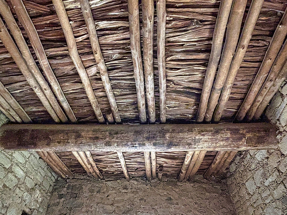
The pueblo, built starting in the 800s AD and occupied for several hundred years, was an elaborate stone structure that included dozens of interconnecting rooms and multi-story buildings. We were able to walk through some of the rooms could see the quality of the stonework...

...and attention to detail – the doorways of 8 adjoining rooms lined up perfectly.

One side of the structure was aligned with the sun's shadow during the equinoxes and helped them determine planting and harvesting cycles.
There are still original wooden ceilings and supports in some portions of the pueblo dated at over 900 years old.
There is also a large Kiva on-site, a circular gathering room that was reconstructed by an archeologist in the 1930s. It was used for community meetings and religious ceremonies.


There were several smaller kivas throughout the pueblo. During excavations, in addition to pottery and arrow tips, archeologists found a child’s sandal, some woven belts and objects that came from very distant places – shells from the Pacific Ocean, and stone objects from South America, indicating extensive trading with people thousand of miles away.
While we marveled at what these ancient people had accomplished, a very recent discovery of 20,000-year-old human footprints, found south of this site in White Sands New Mexico, reminded us that as ancient as this civilization was, there were other civilizations in North America much more ancient. 20,000 years ago, ice still covered much of North America, and the Bering Land bridge, once thought to be the way ancient people used to get to North America, was still covered in glaciers. The four-foot-tall humans who made these footprints probably hunted giant sloths and woolly mammoths, now long extinct.
We spent the next day running errands in the nearby town of Farmington, New Mexico, then had another long drive to Santa Fe where we would meet up with our friends the Roths and get ready for our five-day visit to the Albuquerque Balloon Fiesta.
While in Santa Fe, we visited the Meow Wolf art collective, sponsored by Sante Fe resident George R.R. Martin (author of Game of Thrones).

The current exhibition, called House of Eternal Return, was a sort of fun house/art exhibition created by 30 different artists. An exhibition that you explored on your own, with lots of hidden passageways, it was on the mind-bending side.


Then, of course, it was on to the Albuquerque Balloon Fiesta, which you can read about in another blog post. The Fiesta is mostly an early morning/evening experience, so we had some other opportunities to explore the area.
One thing that had been on Doug's bucket list for a long time was a visit to the Trinity Site, where the world's first atomic bomb was exploded in 1945. It sits in the middle of the Army's White Sands Missile Range, and is only open to the public two days a year - the first Saturdays of April and October. We took the 90-minute drive down from Albuquerque following Saturday morning's mass balloon ascent.
The site sits in a remote valley surrounded by New Mexico peaks.

The Trinity site is still mildly radioactive (but not dangerously so).


They had samples of "Trinitite," molten glass created during the explosion which can still be found on the site, along with geiger counters that clicked away when exposed to the trinitite.


Our son Mace had flown in to join us at the Fiesta. One evening the setting sun illuminated nearby 10,700-foot-high Sandia Peak...

...and we resolved to drive up to the peak another evening to take in the sunset and the beautiful panoramic views of Albuquerque below us. It was as spectacular as we'd hoped.


OK, that's it for this long blog entry. Thanks for your patience in reading through.
After we left New Mexico, we headed up to Colorado to see the Rockies before we headed east toward home. More about that in a new blog entry coming soon!
Our countries geology is simply amazing!! The shapes, colors, designs in various rock outcroppings...!!! And, you have done an incredible photo journal to bring us all along.
Looking forward to catching a glimpse of you back here in VA.