The U.P.
- dougsmith51
- Jun 3, 2021
- 4 min read
Michigan is one of those states that is divided into two, non-touching parts (ironically, Virginia is another). Having spent a few days in Michigan's Lower Peninsula, it was time to move on to the Upper Peninsula (also known as the U.P.).

We started our explorations halfway between the two peninsulas, spending a day at Mackinac Island, which sits east of the Mackinac suspension bridge that spans the two parts of the state. You can only get to the island via ferry, which we boarded on a windy and cold (45 degrees at the time) day. We'd visited Mackinac Island in 2002 on our family Road-Trip-Across-America, where we'd sat atop the ferry with our kids and enjoyed the views.

Not this time, though. With the wind and choppy waves, the chilly waters were splashing on our windows, obscuring views, and onto that upper deck.
During our time touring the island, the wind quieted and the temperatures settled into the mid-50s.
Mackinac Island does not allow any automobiles, which is part of its charm. Transportation is either by bicycle or by horse. Even the delivery trucks are drawn by work horses.

There are many charming Victorian homes, beautiful gardens, sweeping vistas and a Revolutionary Era fort overlooks it all. We went up for a visit.


Most of the island is a Michigan state park. Viewed from Fort Mackinac, you can see how small the tourist town is. The Mackinac Bridge is just visible on the horizon.
We arrived in time for the cannon-firing demonstration - a big hit with some visiting schoolchildren (click on the movie below to play).

From our 2002 visit, we remembered that there was a bike path that circumnavigated the island, a distance of about 8-9 miles...

...so we rented bikes again from a local company (there are literally thousands of rental bikes available to feed the mid-summer demand) and took off for a beautiful ride in cool temperatures, with waves lapping the shoreline.

Along the way, we saw Arch Rock, and decided to climb the 206 steps to the top to see it up close.
After a very nice dinner at one of the local establishments, we thought we would climb up to the Grand Hotel for coffee and dessert. However, after seeing this sign specifying its strict dress code, and the fact that visitors must pay $10 each just to enter the hotel, we demurred.

This far north and only a few weeks to the summer solstice, the sun doesn't set until after 9:30 pm. We took one of the evening ferries off the island, and this time, we did decide to ride up top (despite the wind chill).
The next morning, we crossed the Mackinac Bridge into the U.P. We were glad that the winds had died down, otherwise it would have been a white knuckle drive.

We scheduled a one-night stopover in a campground near the small town of De Tour, Michigan that lies just across Lake Huron from Canada, and lucked into a beautiful campsite (one of the prettiest we've stayed at) with our own private sitting dock! We also enjoyed a beautiful sunset.


We moved on to Pictured Rocks National Lakeshore, another area we'd visited on our 2002 RV trip. Sitting on the southern shores of Lake Superior, Pictured Rocks is know for a 15 mile stretch of limestone cliffs where leaching minerals have colored the limestone in strips, bands, and other patterns. To really see the effects you take a boat cruise from an NPS concessionaire.

We'd booked a "sunset" cruise, but when we left it was cold and cloudy. Nevertheless, the patterns were still dramatic.
One formation is known as Indian Head Point (you can probably see why).

The shoreline also has several arches. One of these collapsed about 60 years ago, leaving a tree perched on top with its root connected to the shoreline but now just hanging in the air.
Predictably, just as we left the cliffs area to return to port, the setting sun finally came out.

Pictured Rocks is much more than just the cliffs, and the park stretches along the Lake Superior shoreline for more than 40 miles. We stayed in an NPS campground close to where the Hurricane River empties into the Lake.
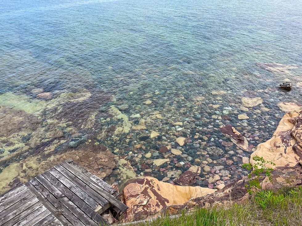
There was a trail from the campground to the Au Sable Lighthouse, and we hiked out for the view. One of the most impressive things about Lake Superior is how clear the water is (the Lake is the largest and cleanest of all the Great Lakes).

There were beautiful flowers along the trail (including pitcher plants and trillium) and butterflies were busy pollinating the lilacs.

In the late 1800s and early 1900s, this area of the U.P. was extensively logged. In a shed, we could see a pair of giant wheels that were used to carry the logs out of the forest. Interestingly, the logs were lashed to the underside of the axle to eliminate the chance that it would tip over.

At the eastern edge of Pictured Rocks are 450-high foot dunes and a beautiful cascading waterfall.


On our way out of the Lakeshore, we stopped for a different view of one of the cliff formations, Miners Castle, which we'd first seen on our cruise.


We continued our way west, crossing the top of Wisconsin and arriving at Duluth, Minnesota on the western edge of Lake Superior. We flew home to Virginia for a Smith family reunion (our first time all being together in two years), then returned to continue our travels. More in our next blog post!


Comments